The Lusk Maps of NYC “Racial Colonies”
One hundred years ago today … the Lusk maps were in circulation. They designated “the location and extent of racial colonies,” in, respectively, Manhattan and a part of the Bronx; and Brooklyn.
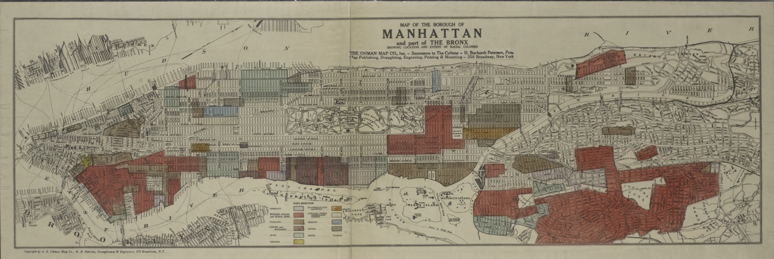
Lionel Pincus and Princess Firyal Map Division, The New York Public Library. "Map of the borough of Manhattan and part of the Bronx showing location and extent of racial colonies." The New York Public Library Digital Collections. 1920.
These were the public versions of the maps that had been prepared by New York State’s Lusk Committee, “The Joint Legislative Committee Against Seditious Activities,” formed in 1919. The internal, state versions of the maps had been used as tools of the repressive anti-dissent campaign popularly known as the Palmer Raids. Sometime in 1920, the maps were published by commercial map concern Ohman Map Company, located at 258 Broadway. (Our research has not turned up a specific date of publication.)

Note: we have addressed the Lusk Committee in several posts, including those of March 18 and 25, 1920 and April 28, 1920
The maps indicated neighborhoods by the following categories:
Germans
Russian, Polish and Other Jews
Italians
Czechs and Magyars
Irish
Chinese
Scandinavians and Finns
Syrians, Turks, Armenian Greeks
Fench
Negro
Mixed
– Jonathan Goldman, December 17, 2020
TAGS: race, ethnicity, surveillance, suppression, neighborhood